
Sadly, summer is coming to an end. But, because of this, I am making a special deal on my kayaks! As of today, the price will be $15/kayak for a trip instead of $20. This means taking that new girl out on a date just became affordable!
The price will remain the same for insurance and transportation.
Friday, August 13, 2010
Thursday, July 22, 2010
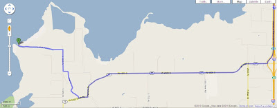
Spanish Fork River Directions
Here is a link to the Google maps directions
Directions:
There will be a place to put in at the end of the road. The road is only paved half way out to the lake, but its a pretty good dirt road. Oh, and don't try to drive along the beach even though it looks like there is a road there unless you have a vehicle equipped for it. I have seen many cars stuck in the sand and in holes in the road out there.

Directions:
- Springville Exit next to Walmart (I-15 Exit 260)
- Head West until a "T" intersection.
- Turn Right
- Turn Right again on the first road (River Road, but the sign is TINY).
- Follow this road out to the lake.
There will be a place to put in at the end of the road. The road is only paved half way out to the lake, but its a pretty good dirt road. Oh, and don't try to drive along the beach even though it looks like there is a road there unless you have a vehicle equipped for it. I have seen many cars stuck in the sand and in holes in the road out there.


Spanish Fork River
So I haven't done much with my kayaks lately, but I have a great excuse...I'm getting married.
OK, now that we have that cleared up, why don't I tell you about a pretty little spot I found last year to kayak. I guess I should have mentioned it sooner. The directions are below, it is the outlet of the Spanish Fork River into Utah Lake from what I can tell. Others call it Sandy Beach, for obvious reasons, although they go there typically more for bonfires and fishing.
The river is much like the Lower Provo, but narrower. The flow of the water is basically nothing, but I did notice a little speed on the way down river. It is dredged too, so there is no need to worry about hitting rocks and things.
My brother and I pushed as far up this river as we could and after a good long ride (sorry, it was last year so I don't remember how long) we still hadn't reached the end of the dredged water. We had a great ride though. Trees line the sides, so you are shaded the whole time, and there is plenty of wildlife especially since you are farther from the city. We saw a couple of beavers on the shore that weren't scared of our boats, and a group of deer ran through the water right in front of us!
The put in location is close to Utah Lake, so if you are interested in that part of the water instead you have your choice. The lake is really shallow here, in fact I have seen fishermen wade probably a quarter mile off shore and still only be up to their waste. I guess this depends on the time of year-I have heard rumor that when the lake is low the whole area is actually sandy, but other times it may be deep. I am not very aware of the effect this has on the waves, so be careful if you are out in it.
The beach north of the road is a fun area for bonfires and other parties. It seems to be mostly HS/College kids there, but I'm fairly sure you could find an area away from it all or not at night if you are with your family.
Directions will be posted separately.
Tuesday, May 18, 2010
Upper Provo River
So...I know this blog is called Provo River Kayaks even though I mostly talk about the lake. I think it just sounded cooler than Utah Lake Kayaks.
Anyway, I thought I would post a link here that gives some information including average drop and average CFS (cubic feet per second) rates for the upper river. This is a part of the Utah Valley visitors center website (http://www.utahvalley.org/).
Although I can't rent my kayaks for use on this area, it is still a lot of fun to take a raft/kayak/inner tube down. I have taken the first leg of the Provo River from Deer Creek to Vivian and it is a really fun ride in an inner tube.
For those of you curious people, I don't rent my boats for the white water stuff because:
- It hurts my boats too much when you hit rocks.
- It is a lot more dangerous. (It is not uncommon to capsize.)
- This raises liability issues that are less of a concern on flat water.
- I don't have skirts to keep the spray out. (I ended up stopping three times just to dump the water out of my boat.)
Wednesday, April 21, 2010
Kayak to Hawaii?
 OK, so I mentioned crossing Utah lake recently. This trip seems like the next logical step, right?
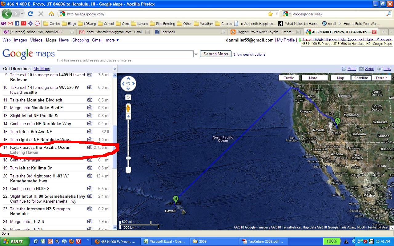
In case you cant read it, this is google map's directions from Provo, UT, to Honolulu, HI. Step 17 recommends:


Monday, April 19, 2010
Island
So, I'm building an island. Pictures and details to come, lets just say it will be awesome. It will be a cool destination and I'm planning on making a pirate map to show how to get to it. Get excited, but not too impatient. It may take a couple of months to finish.
Monday, April 12, 2010
Vineyard

Saturday we took a trip out on the lake farther than I've been before. As you can see from my map we took off at a little park just north of Vineyard (a little community west of Orem and north of UVU). The park needs some green, but there are two picnic tables and a bike path to enjoy there. It is hiding down the hill from the road, so it can be easily missed even if you are looking for it. The bike path is paved and had a number of families enjoying the summer weather.
The park has a little bit of a beach right on the lake which is nice and a long stretch of shallow sandy water, but it wasn't my favorite park. I may be a little bias-my memories of it go back before it was a park to huge bonfire parties with truckloads of pallets. The fires have been banned now and replaced with a semi-manicured picnic area. Maybe if they could keep a little grass at least, but maybe the soil makes that unfeasible.
After enjoying the lake for a while we turned around to go back and found that we had drifted north (a common thing on the lake. I recommend looking behind you on a regular basis so you know where you are.) Thinking we had drifted south, I ended up missing the park and adding an unexpected loop to our trip. We ended up going nearly 5 miles in the end.
My review of the Vineyard area is pretty low. I would rather go south or stay on a river, where most of these posts are about, but if you live up north, or you want a quick way to get out on the body of the lake, this is not a bad option.
It turns out that crossing the lake is approximately a 5-6 mile trip, one way, if you go straight the whole time. Maybe that will happen next week...
Wednesday, April 7, 2010
Summertime!
I know summer is just beginning, but the allure of the lake is definitely back. I have been out three times already-I need to put up some pictures. I went with a friend today to the east bay marshes and saw a whole bunch of birds. I've never been one for birdwatching, but it was pretty cool to know what I was seeing. Although I'm sure there is more, here's the list that I can remember:
Grebe
Double-crested Cormorant
Pelicans (So amazing especially when they fly in a long chain together)
Beaver (not technically a bird)
Coots (my favorite because they can walk on water)
The state bird of Utah:Seagulls
Great Blue Heron
Night Heron
Paired off Mallards
Red-winged Blackbirds
Yellow-headed Blackbirds
Carp jumping fully out of the water (not very good at being a bird)
Unfortunately none of these are my pictures. I think I will start taking a camera and working on this list.
Monday, February 1, 2010
Utah Lake in the Winter


This is why I dont kayak on Utah Lake in the winter. It is REALLY pretty though, if you ever get a chance to get out on it. It will surely surprise you. Ice mountains, Huge fields of tiny crystal formations, patches of smooth clear ice. It is pretty amazing. Be careful though, it has potential to be dangerous, although through most of the winter the ice is plenty thick. Check out this guys blog for more pictures and stuff. He actually ran across the lake and back and took some fantastic pictures along the way.
Subscribe to:
Posts (Atom)